


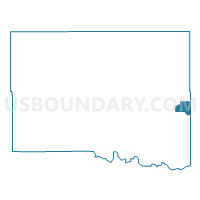
Voting District 220, Canadian County, Oklahoma
About
Outline

Summary
| Unique Area Identifier | 653578 |
| Name | Voting District 220 |
| County | Canadian County |
| State | Oklahoma |
| Area (square miles) | 5.70 |
| Land Area (square miles) | 3.74 |
| Water Area (square miles) | 1.96 |
| % of Land Area | 65.64 |
| % of Water Area | 34.36 |
| Latitude of the Internal Point | 35.49976250 |
| Longtitude of the Internal Point | -97.69218300 |
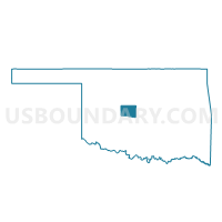
Maps

Graphs
Select a template below for downloading or customizing gragh for Voting District 220, Canadian County, Oklahoma


Neighbors
Neighoring Voting District (by Name) Neighboring Voting District on the Map
- Voting District 204, Canadian County, OK
- Voting District 206, Canadian County, OK
- Voting District 216, Canadian County, OK
- Voting District 219, Canadian County, OK
- Voting District 222, Canadian County, OK
- Voting District 308, Oklahoma County, OK
- Voting District 463, Oklahoma County, OK
Top 10 Neighboring County Subdivision (by Population) Neighboring County Subdivision on the Map
- Oklahoma City Southwest CCD, Oklahoma County, OK (429,392)
- East Canadian CCD, Canadian County, OK (86,541)
Top 10 Neighboring Place (by Population) Neighboring Place on the Map
Top 10 Neighboring Unified School District (by Population) Neighboring Unified School District on the Map
- Putnam City Public Schools, OK (119,728)
- Yukon Public Schools, OK (36,938)
- Western Heights Public Schools, OK (15,386)
Top 10 Neighboring State Legislative District Lower Chamber (by Population) Neighboring State Legislative District Lower Chamber on the Map
- State House District 41, OK (46,325)
- State House District 43, OK (44,484)
- State House District 84, OK (34,376)
- State House District 90, OK (31,669)
Top 10 Neighboring State Legislative District Upper Chamber (by Population) Neighboring State Legislative District Upper Chamber on the Map
Top 10 Neighboring 111th Congressional District (by Population) Neighboring 111th Congressional District on the Map
Top 10 Neighboring Census Tract (by Population) Neighboring Census Tract on the Map
- Census Tract 3009.01, Canadian County, OK (5,914)
- Census Tract 1069.03, Oklahoma County, OK (5,805)
- Census Tract 3009.05, Canadian County, OK (4,436)
- Census Tract 3009.04, Canadian County, OK (3,643)
- Census Tract 3009.02, Canadian County, OK (2,490)
- Census Tract 1067.04, Oklahoma County, OK (2,243)
- Census Tract 1069.11, Oklahoma County, OK (1,755)